


HOME > Groundwater Locator > Pinpoint Groundwater Exploration System

AQUA Visualizer can pinpoint the location of underground vein, thus it allows to expand possibilities to
solve challenges like water resources development promotion and agricultural production development.
Conventionally, water veins have been estimated by comprehensive analysis of both geological structures that is acquired by groundwater electrical exploration, and the studies on the structures. This method could not ensure the accuracy as the major contents depended on researchers’ experiences and intuitions. Accordingly, trial prospecting was required to confirm the actual condition. High cost, but low possibility to find the water veins … AQUA Visualizer can be the best solution to this problem.
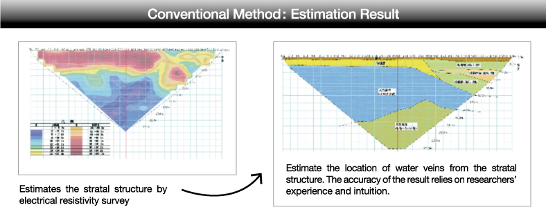
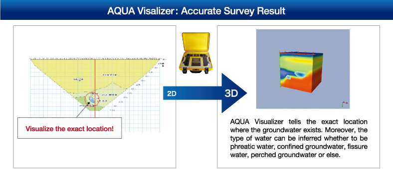
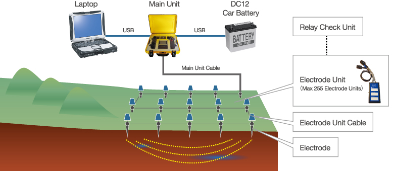
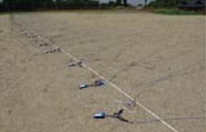
Electric resistivity method has been widely used as one of the exploration methods. We developed the state-of-the-art technology that identify the groundwater vein by using the phenomenon that there is a quite big variability in electrical resistivity, in where the groundwater exist. Highly precise result can be obtained compared to the estimation result of stratal structure.
![]()
By acquiring the data three-dimensionally with the survey lines set both in horizontal and vertical directions (meshedgrids), it can be used for planning of groundwater use / promotion such as the construction of ground water dam.
![]()
By the continuous survey on the distribution of groundwater veins around farmlands in order to understand and analyze the flow changes, it is expected that the efforts towards productivity improvement and yield prediction in the light of climate forecast are realized.
![]()
It decreases risks of water use and also it increases the credibility/value of the company by identifying the location of the water veins around industries or farms, and accordingly promoting its appropriate conservation plan.
![]()
It can be used for the water leakage survey on dams/reservoirs. We have already given numbers of actual water leakage survey results on the wide range of scales in Japan.
![]()
It is possible to detect the water leakage from underground aqueduct and the survey result can be used for the control of non-revenue water. Especially, this survey is useful in the case that the exact location of the buried pipe is not clear.
It is expected that future applications will be developed and constructed one after another.
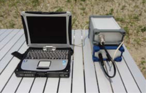
Introduction of the Basic Model
![]()
![]()


Copyright © AQUANEXT All rihgts reserved.
![]()